BELLERBY & CO
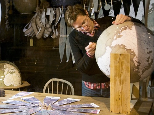
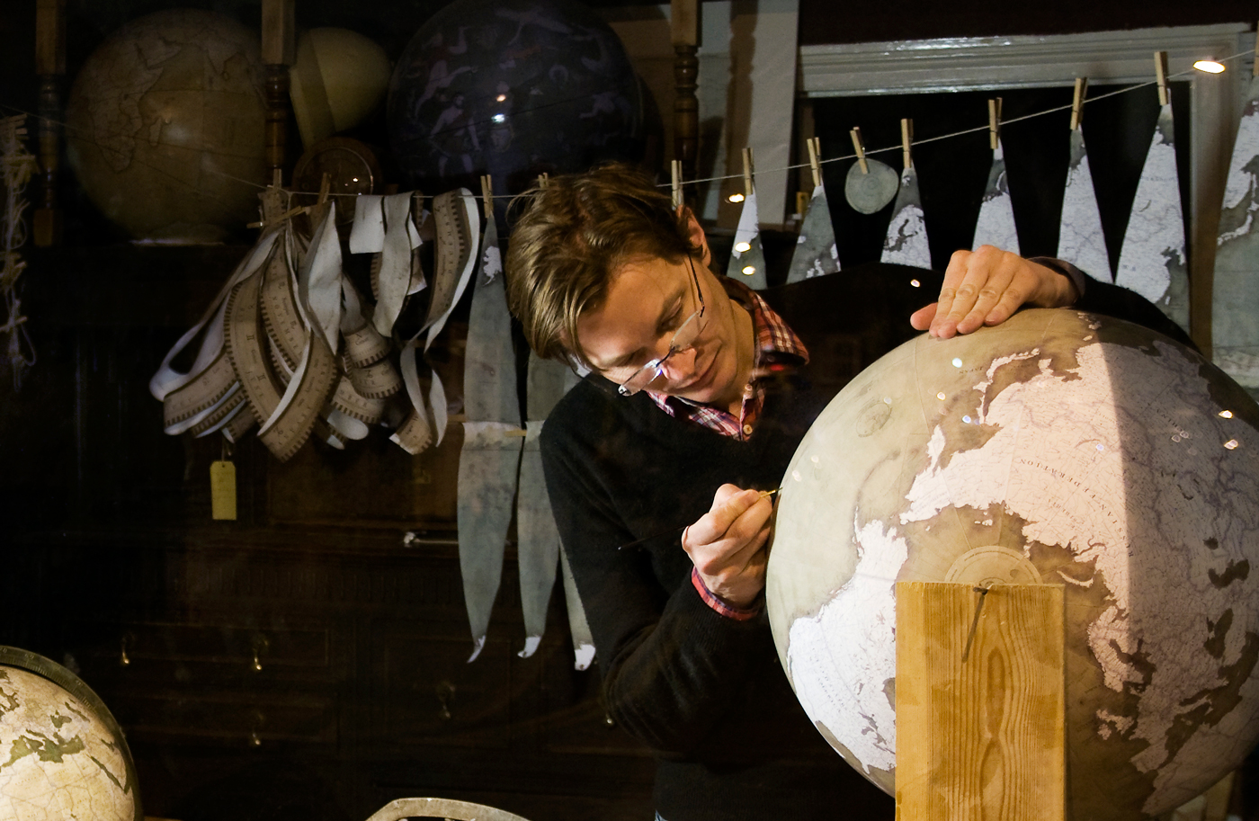
Bellerby & Co are a team of artisan globemakers from London that have revived - and perfected - the lost art of making globes of the finest quality and precision. Peter Bellerby wanted to create a perfect globe as a present for his father's 80th birthday, and what started as a hobby has since turned into a successful business, with Bellerby & Co. globes being featured in Hollywood movies and sold in the upmarket Harrods department store. "We have been able to raise globe making to a level that has probably not been seen for two centuries or more, and invented an entirely new way, which has not been successful previously," says Bellerby.
More information: www.bellerbyandco.com
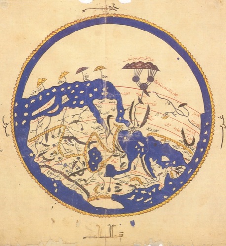
When people believed the Earth to be flat, cartography was a matter of depicting the known world encircled by the ocean. After the concept of a spherical Earth demolished the myth of a disk floating in the seas, mapmakers faced a challenge: how to transfer a round planet onto a flat map?
ROUND TO FLAT
Map projections - mathematical transformations of a sphere to a flat surface based on grid of latitude and longitude lines - have challenged cartographers for centuries.
Greek scientist Eratosthenes of Cyrene was the first to map out the world using parallels and meridians in the third century B.C. His successor Claudius Ptolemy, an Egyptian scientist and mathematician, refined the map projection in the second century B.C. He assigned coordinates to known geographic locations and measured latitude from the equator.
In Ptolemy's projection, meridians appeared as curved lines, reflecting the spherical shape of the Earth. This approach, however, presented a problem for sea navigation. With curved meridians, sailors would need to constantly adjust the compass bearing if they were to draw a straight line and try to follow it to reach their destination.
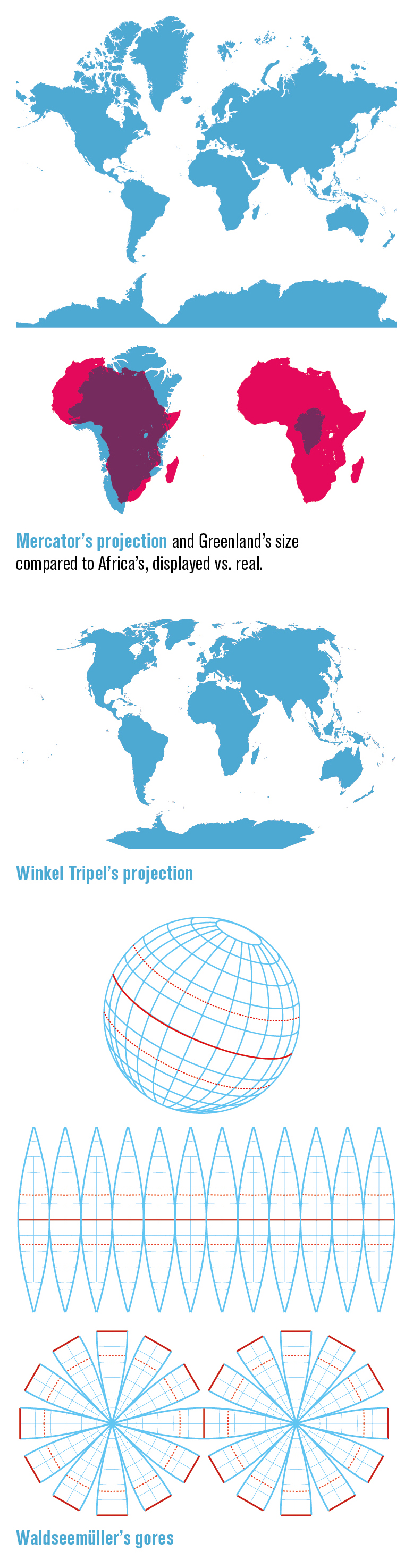
The true revolution in nautical charts - and efforts to stretch the Earth onto a flat surface - came in 1569, when Flemish cartographer Gerardus Mercator designed his projection with meridians parallel to each other. As a result, any straight line drawn from point A to point B would match a compass bearing.
This projection stretches the points where all meridians meet at the poles into lines equal in length to the equator. As a result, it shows Greenland to be bigger than Africa. In reality, Africa is 14 times larger.
German mathematician and astronomer Karl Brandan Mollweide created his elliptical projection in 1805 with the aim of accurately representing area proportions. Here, the central meridian is half the length of the equator, which solves the Greenland problem but sacrifices the accuracy of angles and shapes.
The 20th century saw a vast number of new projections appear, some of which were radically different in their shape and properties. American architects Bernard Joseph Stanislaus Cahill and Richard Buckminister Fuller, in pursuit of minimal distortion, invented foldout projections. Cahill's Butterfly World Map was a rubber-ball globe, cut at meridians into eight adjacent triangular lobes. When pressed onto a flat surface under the glass, it would become flat. His colleague Fuller projected our planet onto a surface of an icosahedron, a shape with 20 triangular faces, which unfolded into a flattened two-dimensional Dymaxion map.
In 1988, the National Geographic Society (NGS) adopted the Robinson projection by an American geographer Arthur H. Robinson, which deliberately distorted some areas in favor of creating an aesthetically pleasing way of showing the globe as a flat image. A decade later, NGS switched to Winkel Tripel projection by German cartographer Oswald Winkel that attempted to minimize the distortion of three elements: area, direction and distance.
However, it is the Mercator projection that is still widely used for navigation today. While there are no regulated standards on projections used for electronic navigational charts (ENCs), many of them rely on the Mercator projection. Google Maps is another example.
FLAT TO ROUND
Maps may be easier to store and view on screens, yet only globes can accurately represent the Earth. Historians believe the first globe existed as early as the second century B.C., and the oldest surviving terrestrial globe dates back to 1492. To meet the demand for globes in the 16th century, German cartographer Martin Waldseemüller created gores, wedge-shaped segments of a map that could be printed, cut out and glued onto a wooden sphere. A similar process is still used today.
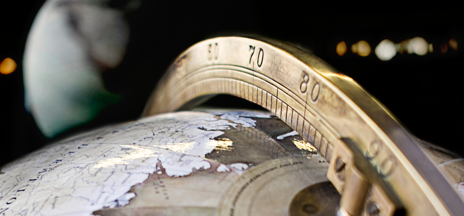
As globes change status from practical to decorative, the accuracy of gore production and application may have become secondary. However, this is not the case with Peter Bellerby, a contemporary globemaker from London. Bellerby set out on a quest to create a perfect globe after discovering that no current globemakers produced accurate models. In his passion for precision, he spent 18 months perfecting the goring process and creating a custom software solution to morph a map into gores. Bellerby & Co. uses an equi-rectangular projection and a different number of gores depending on the size of globe - the bigger the globe, the more gores are required.
Bellerby believes that in a hundred years, the Bellerby & Co. globes may be the only ones of interest from our time; the others will not have survived or be considered unworthy of restoration.
When globes vanish from the face of the Earth and only maps remain, the world may as well be proclaimed flat, again.